
Putangirua Pinnacles track open or closed? – it was open in 1948
The Putangirua Pinnacles – the story of a WTMC trip to the Putangirua Pinnacles in 1948 with added photos taken in 2024.

Revised 3 June 2025
The track to the Putangirua Pinnacles is now open, however, there is still an alert for the area on the DOC Website.
The alert relates to flood damage on the track along the stream before accessing the marked climb up the Pinnacles Track to the lookout.
DOC also notes in the alert that there is now no access to the pinnacles along the stream.
Four WTMC members spent a pleasant day at the pinnacles on the 2 June 2025 and the following was apparent:
- The ‘Track Closed’ sign at the carpark had been removed, and orange triangle track markers have been placed along the stream bed. However, as noted by DOC in their alert many of these have been damaged by recent floods
- The stream track markers lead to the start of the well-maintained Pinnacles Track that climbs gradually to the lookout platform
- The view from the lookout is somewhat disappointing with some scrubby trees blocking most of the view
- The track from the lookout directly down to the stream has a ‘Tracked Closed’ sign, however, it can be used by reasonably competent hikers – but note that there are a couple of slips to be bypassed
- Reasonably competent hikers could, and were, following the stream to the base of the pinnacles – but this route is unmarked
- Scroll to the bottom of the story for a map of the relevant tracks.
So in summary, visitors were mainly following the DOC orange triangle markers to the lookout, but there were a few others using the stream bed directly to the base of the pinnacles, and some making a circuit by using the ‘closed’ track from the lookout directly to the stream.
And regardless of all this it is interesting to read a Putangirua Pinnacles WTMC trip report of April 1948, written when the club was less than a year old and had about 60 members. Here is their story with a few of the photos that would have been included if DSLR cameras and web publishing were available at the time [TG.]
PUTANGIRUA PINNACLES – APRIL 1948
Two trucks left Wellington Saturday morning and off over the Rimutakas to Palliser Bay and the Putangarua Pinnacles. A club hunting party had gone ahead the night before and on our arrival we were greeted by Des lying on a stretcher. Des had had an argument, which he lost, with a large loose rock on a scree slide. The truck driver took him back to Wellington and fortunately he fully recovered.
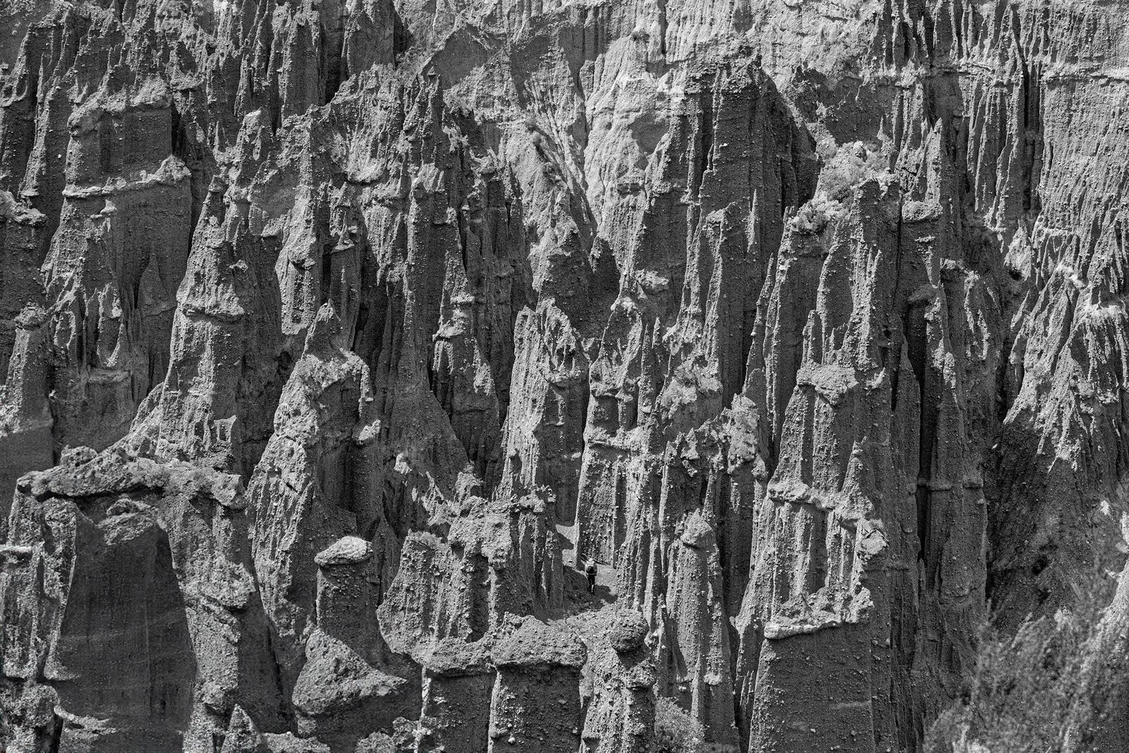
We lunched, pitched our tents, and then set off for the Pinnacle Valley which is about 30 minutes up on the left side from where we camped at the mouth of the creek. We saw the ‘Lion’s Head’, the ‘Organ Loft’, the ‘Cathedral’, and other recognisable features.
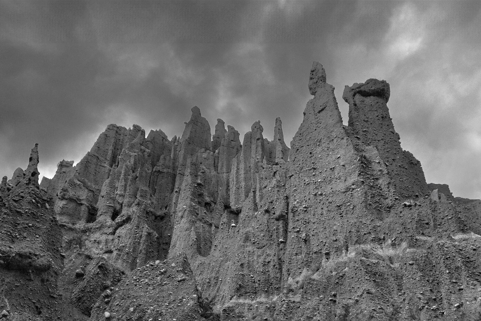
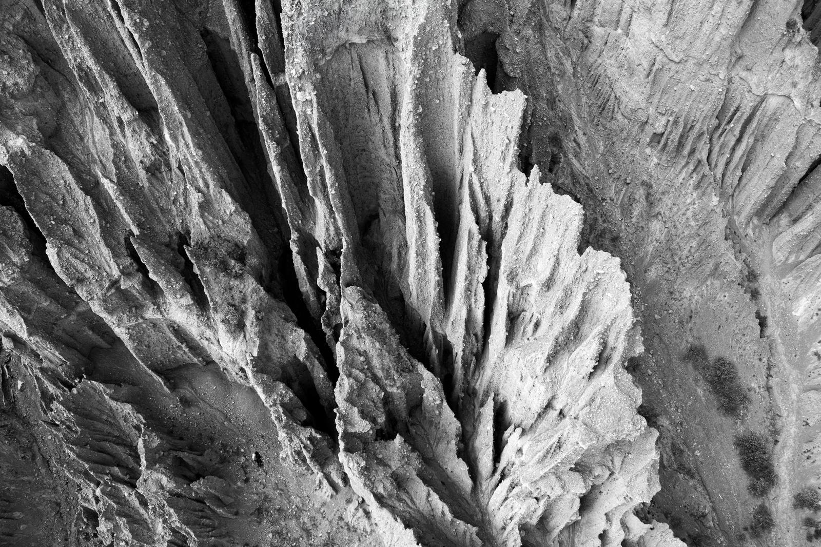
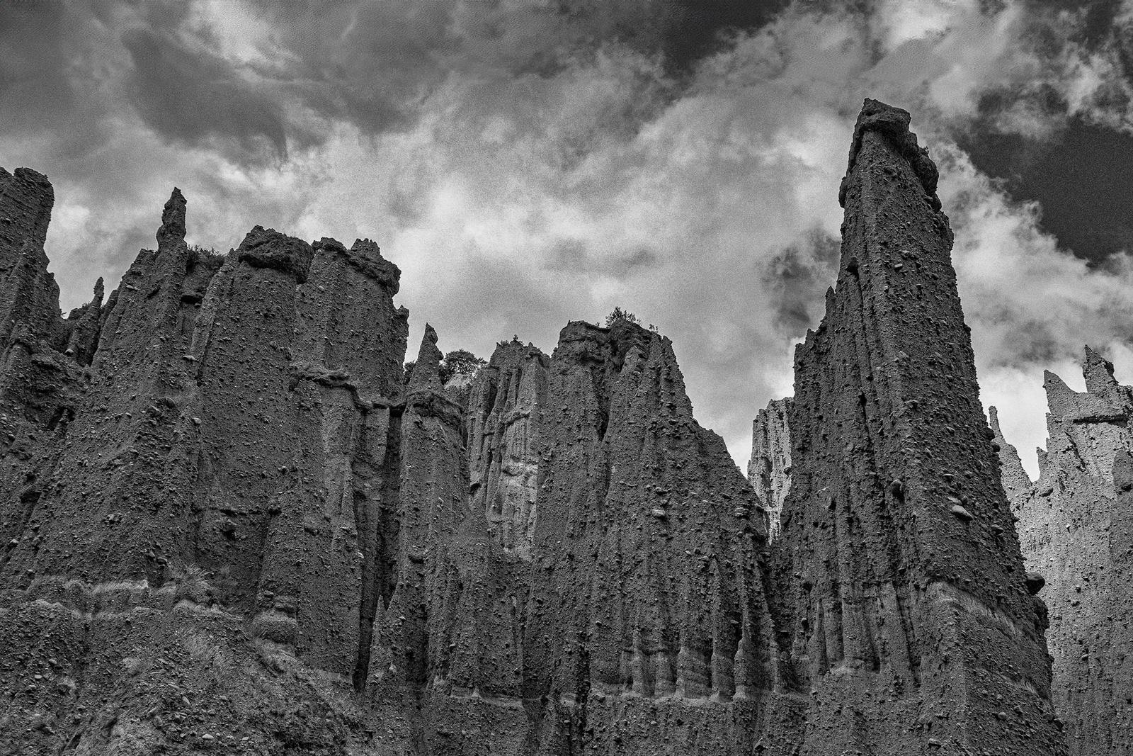
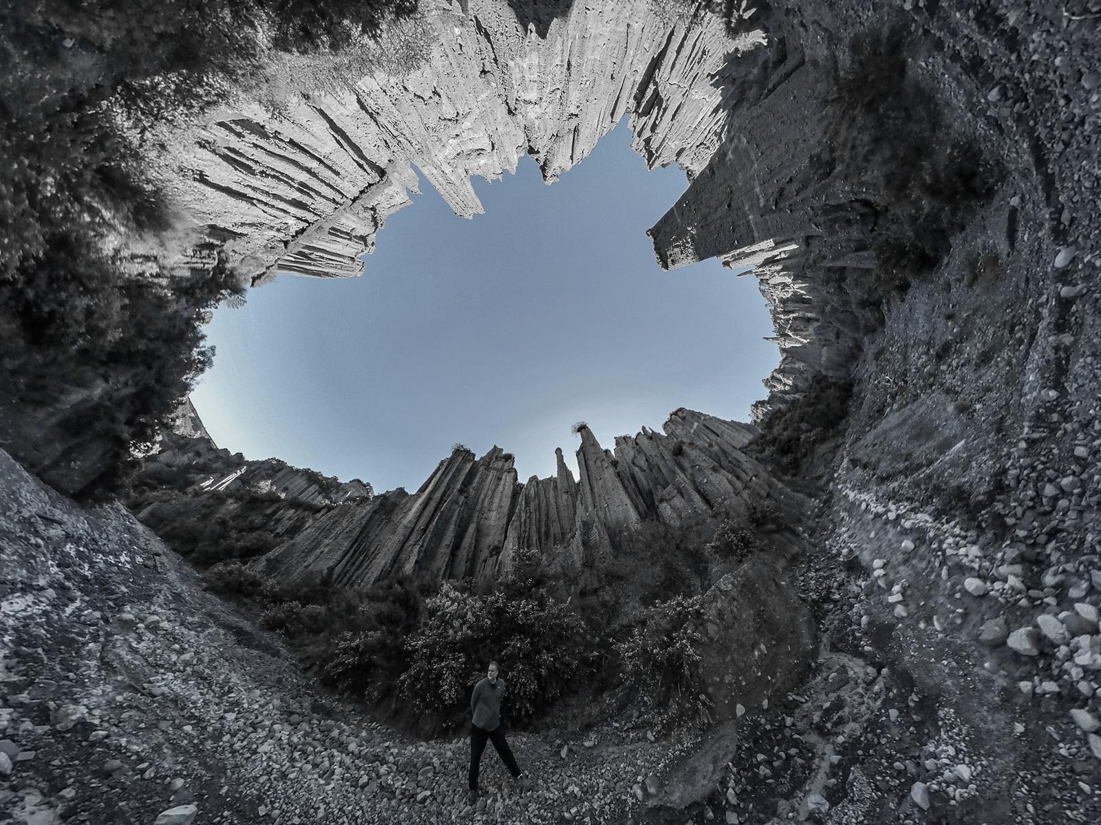
The pinnacles are a unique sight, being carved out by wind and rain from the comparatively soft papa composite. They stretch from the floor of the valley to about twenty feet [6 m, but actually many are taller than this – TG.] The shapes they take on are determined by the position of the rocks that form part of the composite. The whole area in this part of the bay is well eroded, and covered with scraggy scrub when there is any – although there are some surprising bushed valleys near the coast.
The climb among the pinnacles is unique. Between them are narrow guts the height of the valley, and the floor covered with wet papa and stone something like a coarse concrete mix.
Although the pinnacles themselves cannot be climbed the party went to the head of the valley with some returning via the Putagarua Creek, and others crossing into the next valley.
The usual stew featured for tea with Laurie and Albert arriving just as the camp fire was lit. They had come the hard way—Orongorongo River, Wharekahau Saddle and Lake Ferry [about 35 km over the Remutaka and somehow crossed Lake Onoke – TG.]
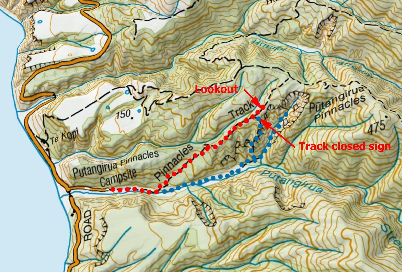
Putangirua Pinnacles Route Map
Red – DOC marked track
Blue – unmarked or closed trail.